SIUE students help introduce high school students to advanced mapping technology
Edwardsville High School Seniors Emily Lombardi and Nickie Cashdollar didn’t plan on studying geography when they begin college next fall.

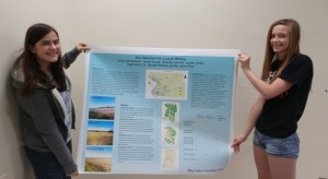
Edwardsville High School students Lauren Serfas (left) and Amanda Schmidt display their poster for their AP Geography course group project. Serfas and Schmidt used Geographic Information Systems technology to survey suitable land for wineries in the Madison and St. Claire counties. The course is augmented by SIUE professor Randall Pearson and six SIUE students. (Photo by Joseph Lacdan)
Lombardi plans to attend Fairfield University (Connecticut) and Cashdollar will study business management. But an advanced placement Geography Course mentored by SIUE Geography professor Randall Pearson and his team of SIUE geography students opened their minds to the evolving technological possibilities of Geographic Information Systems.
Lombardi and Cashdollar each put together group presentations for their final projects using the mapmaking technology April 29 at Alumni Hall.
“No interest in geography at all beforehand. I heard the class was really fun. I thought I would enjoy the class and I learned so much more than I thought I would,” Cashdollar said. “I thought it was just going to be about mapping but it turned out to be more of how humans interact with certain maps, how that kind of thing affects the geography and what we’re doing to the environment, what the environment is doing to us, things like that.”
Cashdollar’s group looked for prime locations to build a paintball field because the options were limited in the area. They considered factors such as proximity to local hospitals and other factors when considering where to build the field. Lauren Serfas, Amanda Schmidt, Savannah Modesitt and Aimee Savoie searched the local Madison and St. Clair counties for ideal areas to build wineries. They considered factors such as landscaping and soil type and also proximity to higher income households. The group eventually decided on three locations: one on New Poag Road in Edwardsville and two in Highland.
Lombardi’s group looked for locations to build a multi-purpose sports training facility with tennis courts, a bowling alley and a softball facility.
“I think it’s a really great opportunity to learn about new technology, especially since technology is getting so big,” Lombardi said. “I think it’s really great we’re learning how to use it, even if we’re not majoring in it later. It’s good to know different skills.”
Lombardi said she learned about the class from a graduate who took the course last year. Since the AP course began in 2012, the class has grown from 17 students the first year, to about 50 students and two classes in 2015-2016. Pearson first discussed the idea of an AP Geography course with Edwardsville Community School District 7 Superintendent Lynda Andre. Pearson and his team of graduate and undergraduate students began hosting final project presentations three years ago.
“[GIS technology] really lets them explore hands-on geography. You can only learn so much out of a book,” Pearson said. “Sometimes you have to go do it. I look at what they’re doing and this is as good as some of the stuff we do in college.”
Pearson also worked with two groups of students who participated in the Unmanned Aircraft Systems for the STEM drone national competition where the EHS students simulated search and rescue. The students went to a ground training school and built their own drones.
“They’re having fun. Why not start our technology and our understanding of geography at a younger level?” Pearson said. “We go into the high school and we work with them and we have fun. We teach them about geography and about math and about GIS and about drones and all sorts of stuff and they love it.”
Filed Under: Geography


